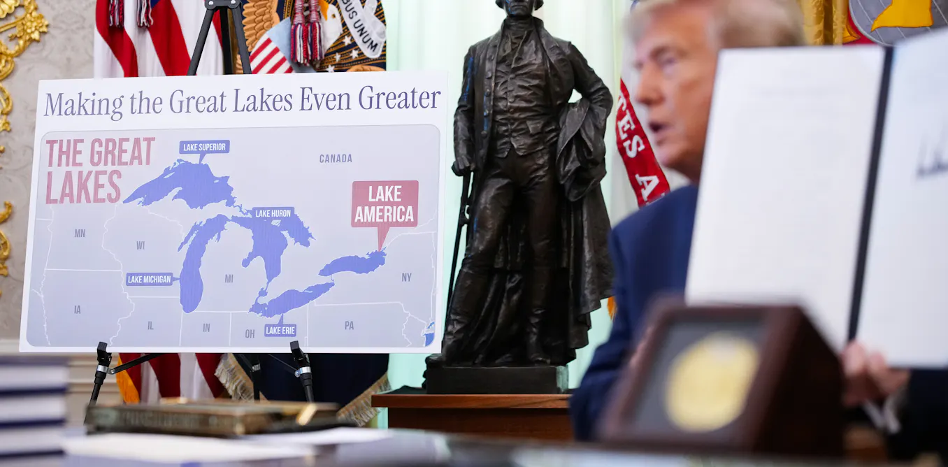
# Who Controls America's Maps? The Hidden Politics of Renaming Places
The fight over what appears on America's maps reflects deeper conflicts about power, identity, and who gets to decide how we name the nation. A geographer's explanation of the procedures behind place names reveals how names on maps are far from settled or neutral.
The United States Board on Geographic Names, established in 1906, holds formal authority over official place naming. Operating within the Interior Department, this board reviews proposals for new names or name changes submitted by federal agencies, states, local governments, and Native American tribes. The process appears straightforward but operates within political and cultural frameworks that have shifted dramatically over the past century.
Historically, American maps reflected the preferences of early European settlers and colonial powers. Indigenous names were systematically erased or anglicized. The Seneca Nation's "Niagara" became fixed on maps. Hundreds of waterways, mountains, and communities lost their original names or saw them altered beyond recognition. This naming practice reinforced colonial dominance and marginalized Native American claims to land and identity.
Today, the board faces competing demands. States and municipalities propose names honoring local historical figures or recent events. Native American tribes petition to restore ancestral names, reclaiming geographic identity on official documents. Environmental groups advocate for descriptive names that reflect landscape features rather than individual people. Each proposal triggers debate about whose history matters and which names deserve permanence.
The procedures matter because official names appear on USGS maps, which schools use in classrooms, governments use in policy decisions, and the public consults for navigation and understanding. A name on an official map carries legal weight. Federal agencies must use approved names in documents. Census data links to official place names. Property records reference geographic designations. Names shape how students learn history, how communities understand their own identity, and how resources flow to regions.
Recent years have seen increased efforts to restore Native American place names. In 2015, the Obama administration renamed Denali in Alaska, replacing "Mount McKinley" with the Koyukon Athabascan name. Multiple states have begun revisiting names imposed during periods of colonization. These changes do not erase history but rather acknowledge that multiple histories occupy the same space and that indigenous peoples' names hold equal legitimacy.
The board's deliberations expose tensions between tradition and revision. Some argue that changing established names creates confusion and erases important figures from memory. Others counter that names reflect choices, not inevitability, and that honoring indigenous heritage corrects historical injustices. Both perspectives contain validity. Maps are not neutral documents. They reflect the values and priorities of whoever controlled the naming process.
The geographic naming system operates less like a technical process and more like a political negotiation. Educators should recognize that maps teach history through naming choices. Students learning from maps absorb unstated messages about whose names and whose stories the nation chose to preserve. Understanding how names get selected, challenged, and changed helps students grasp how official institutions shape collective memory and whose voices receive official recognition.