# When Mountains Become Floods: Climate Change and Himalayan Disasters
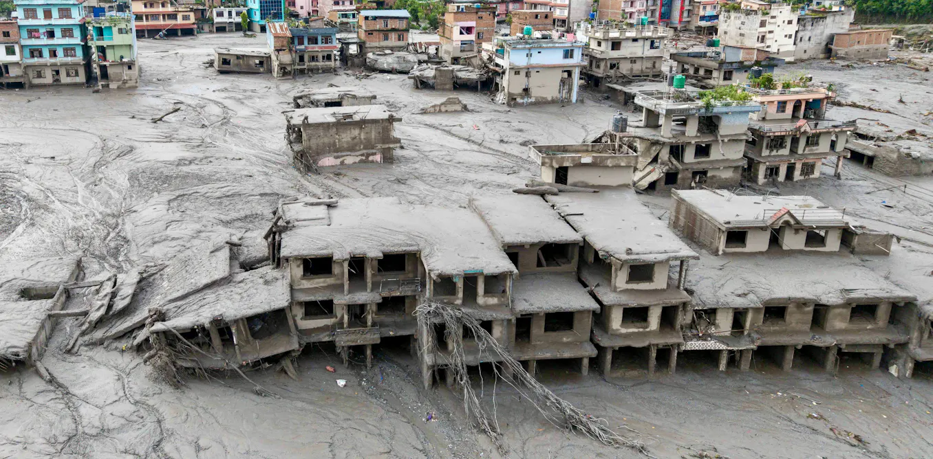
Nepal's glacial lake outburst flood in 2021 killed dozens and displaced thousands. The disaster began with a deceptively simple sequence: warming temperatures thawed permafrost holding rock and ice together. That bond failed. A mountainside collapsed into a glacial lake. The sudden water displacement triggered a wall of water that raced downstream, destroying villages and infrastructure across Nepal's Solukhumbu district.
This pattern repeats itself across the Himalayas and other high-altitude regions where permafrost acts as natural glue binding mountain terrain. As global temperatures rise, that glue weakens.
Permafrost exists in soil and rock at elevations above roughly 3,500 meters in the Himalayas. It remains frozen year-round, even during summer months. The ice between rock particles provides structural stability. When temperatures climb consistently above freezing, that ice melts. Rock loses its binding agent. Slopes become unstable. Rockfalls happen. Sometimes those rocks plunge into glacial lakes, which then overflow catastrophically.
Scientists call these events glacial lake outburst floods, or GLOFs. They move with brutal speed. Water can reach downstream communities within hours. Speed means little warning time. Speed means high death tolls.
Nepal faces particular vulnerability. The country sits directly in the path of the monsoon system and experiences intense precipitation during June through September. That rainfall, combined with glacier melt from warming temperatures, fills glacial lakes at higher volumes than ever recorded. More water in lakes means more potential energy for disaster when a GLOF occurs.
The 2021 flood began when a 200-meter stretch of mountainside broke free in the Chamoli district of neighboring India. The rockfall plunged into a glacial lake. Water sloshed over the dam of moraine, a natural barrier of rocks left behind by retreating glaciers. Downstream, the flood destroyed a hydroelectric dam and killed over 200 people across both countries.
Climate data shows this risk accelerates. Global temperatures have risen approximately 1.1 degrees Celsius since pre-industrial times. Mountain regions warm faster than lowland areas. High-altitude regions in the Himalayas experience temperature increases of 0.5 to 1.0 degrees per decade, roughly twice the global average.
More warming means more permafrost melt. More permafrost melt means more rockfalls. More rockfalls mean greater flood risk.
The number of glacial lakes across the Himalayas has grown substantially over the past three decades. Satellite imagery shows approximately 9,000 glacial lakes now exist in the region, up from fewer than 5,000 in the 1990s. Not all pose immediate danger, but roughly 500 to 800 qualify as potentially dangerous based on their size, water volume, and downstream populations.
Communities in Nepal, India, Tibet, and Bhutan now face cascading hazards. Residents must worry not just about traditional flooding from heavy rain but also about sudden water releases triggered by geological instability. Early warning systems have improved, but mountain terrain makes detection difficult. A rockfall happens in seconds. A GLOF travels at speeds up to 30 kilometers per hour.
Adaptation requires multiple strategies. Infrastructure like reinforced dams and spillways can contain some water releases. Monitoring networks using sensors and satellite data can detect warning signs. Land use planning can restrict construction in high-risk valleys. But ultimately, communities must prepare for a future where mountain floods become more frequent and more powerful as permafrost continues to thaw.